
Find Centennial Streets
A street-by-street search works best when each stop answers one narrow question. The county assessor can identify a parcel and owner of record. ArapaMAP can show the parcel shape, layers, and jurisdiction. The recorder can connect a legal description to deeds or liens. The county voter files can add a dated registration relationship. Historical householder pages can show an older address entry. Those results should remain separate until the parcel, time, and role agree.
Use this order when an address is the starting point. It keeps a false match from spreading across the whole street and gives a clean fallback when one portal does not cover the needed year.
- Standardize the street line with USPS ZIP Code Lookup, using the result for mailing format and ZIP context only.
- Enter the number, range, street name, and unit in the Arapahoe County parcel search. Save the PIN, AIN, situs, and legal description.
- Open the county map viewer and inspect the parcel outline, city boundary, districts, road layer, and adjacent parcels.
- Use the parcel identifier or legal description in the Arapahoe recorded-document search. Check grantor, grantee, reception number, book, page, and recorded date.
- Compare the dated voter list or a historical directory only after the parcel and jurisdiction are fixed. Label every result by role and source year.
A street directory can reveal a record trail. It cannot turn the trail into a complete household list. The best result is a set of carefully named relationships that another researcher can verify.
Centennial Parcel Search Fields
The address search behind the Centennial street directory has a few rules that affect the result set. Arapahoe parcel-search instructions say an AIN must use the exact 0000-00-0-00-000 pattern, with leading zeroes and hyphens. A PIN is numeric, uses leading zeroes, and generally begins with 03. The address search accepts partial or misspelled street names after at least three letters.
Enter the street number or range, street name, and unit as separate fields. Leave out a directional prefix and street type. The search returns six items per page, so an address that looks unique in a short result can still sit beside another parcel or a multipart record. Record the parcel ID before comparing owners or documents.
| AIN | Exact parcel pattern with all zeroes and hyphens. |
|---|---|
| PIN | Numbers only, with leading zeroes; use when the AIN is not known. |
| Number or range | Narrows the address results along a street. |
| Street Name | At least three letters; no directional prefix or street type. |
| Unit | Separates a unit or address entry when the database includes it. |
The parcel detail can show owner, ownership type, owner mailing address, situs, city, neighborhood and code, acreage, land use, legal description, assessed values, sales, building fields, tax links, and map links. A situs is the location of the parcel. A mailing address receives notices. A parcel record does not establish who is inside it.
The Assessor public page routes researchers to the county search and transparency tools, while Assessor data extracts separate parcel, legal-party, transfer, permit, building, and tax-authority files.
For a visual reference, the county’s Address / Parcel Info tool explains how an address is matched to a parcel and jurisdiction.
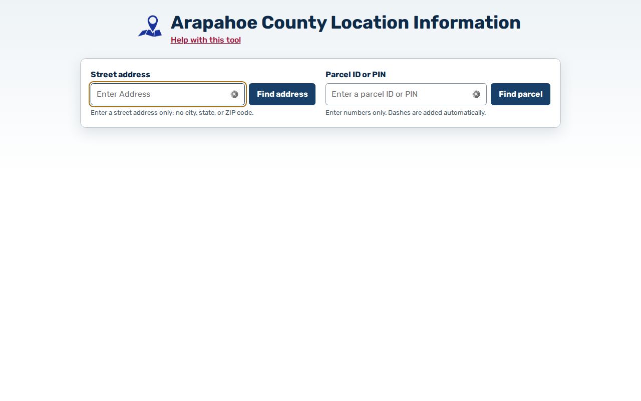
The address image is a reminder to save the jurisdiction and district result along with the street line, since large or multipart parcels can cross a boundary.
The county’s Parcel Search Help adds the exact formatting rules that keep an address search from returning a misleading set.
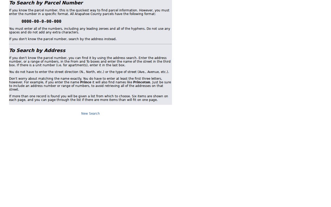
Its search instructions belong beside the number, range, street-name, unit, PIN, and AIN fields used in the county portal.
The Arapahoe County Parcel Search home also shows the point at which an address becomes a county property query.
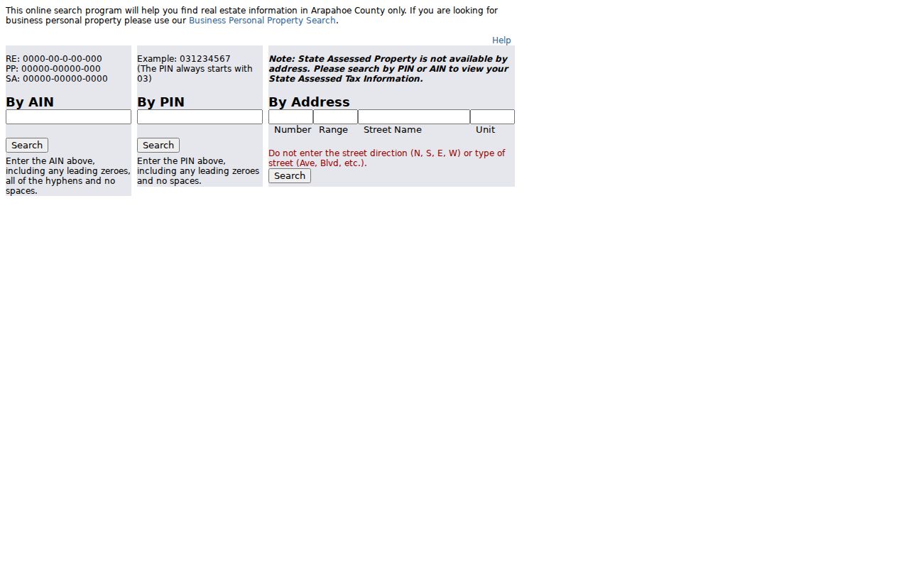
Use the portal result as a parcel lead, then carry its identifier into the map and Recorder sources.
- Parcel
- A mapped property unit identified by a county PIN or AIN.
- Situs address
- The location assigned to the parcel, which can differ from the owner mailing address.
- Plat
- A recorded map or subdivision document that gives legal and lot context to an address.
ArapaMAP Street Layers
ArapaMAP is the map step in an address search. It supports parcel and address information, aerial and street basemaps, identify, measurement, selection radius, buffers, redlines, imports, and printing. A researcher can select a parcel, keep a circle, buffer selected features, or inspect a layer before deciding which neighboring record belongs to the same street segment.
The map also helps separate city limits from a postal last line. Political, tax, school, fire, water, road, and neighborhood layers can overlap without sharing the same boundary. An interior reference point may locate a parcel for jurisdiction purposes without marking the exact entrance. For a commercial or multipart parcel, the first displayed situs may not be the only address.
Use the Address / Parcel Info tool for a focused address or parcel check. Save the map layer name and capture date because GIS layers can change while an older aerial image remains in place.
The county’s ArapaMAP interactive map shows how a street becomes a set of parcels rather than one undifferentiated line.
The ArapaMAP view is geographic evidence. It routes a search to the right parcel and district; it does not prove occupancy or association membership.
Note: Keep the map’s jurisdiction result, assessor situs, and USPS standardized line as three separate fields when they disagree.
Centennial Street Records
Once a parcel is known, the Centennial street directory can move through address-keyed sources in a controlled order. The table distinguishes current property data from documents, voter files, and city records. A row tells you what the source can show, not what every household on the street looks like.
Building, planning, code, and meeting files are especially useful when the question concerns what happened at a parcel. They can document a permit, inspection, zoning matter, or public case without identifying an occupant. The city’s public-records page gives online routes and a request fallback.
| Record Set | Keeper | Street-Level Use | Access |
|---|---|---|---|
| Parcel record | Arapahoe Assessor | Owner, situs, mailing address, legal description | Free portal |
| GIS parcel map | County GIS | Boundaries, layers, adjacent parcels, districts | Free viewer |
| Deeds and liens | Clerk and Recorder | Parties, document type, date, book, page, references | Index and paid copies |
| Voter list | Arapahoe Elections | Dated registration, status, precinct, district, history | List products |
| Permits and code files | City of Centennial | Building, planning, complaint, or public case activity | Online or request form |
The parcel identifier ties the assessor to the map and the deed index. A case number or permit number can tie a city record to the same location. A voter address is a separate dated relationship, so do not use it to fill gaps in the property chain.
Centennial Recorder Index
The Arapahoe recorded-document portal is the deed and lien layer of a Centennial street directory. Quick Search uses a Real Property department selector, a search term for grantor, grantee, subdivision, document type, or document number, a recorded-date range, and a choice between index-only and index-plus-OCR. Date presets range from the last day through the last year. Advanced Search adds party names, grantor, grantee, document type, reception number, Book and Page, legal fields, parcel ID, address, and full-document text.
The date shown by the portal reaches back to June 3, 1872, but county digital-records guidance says the grantor/grantee name index is 1980 to the present. Before 1979, a reception number or Book/Page is normally needed. That split matters on a street where an older deed exists but a name search does not return it.
Result cards can show reception number, Book, Page, number of pages, recorded date, consideration, document status, grantor, grantee, references, document type, and legal description. A free registered account can show a watermarked digital copy. The research notes an unwatermarked copy fee of $0.25 per page and a certified copy fee of $1 per document plus $0.25 per page. Confirm current terms with the Recorder.
A sample civic parcel keeps the field lesson separate from a private household.
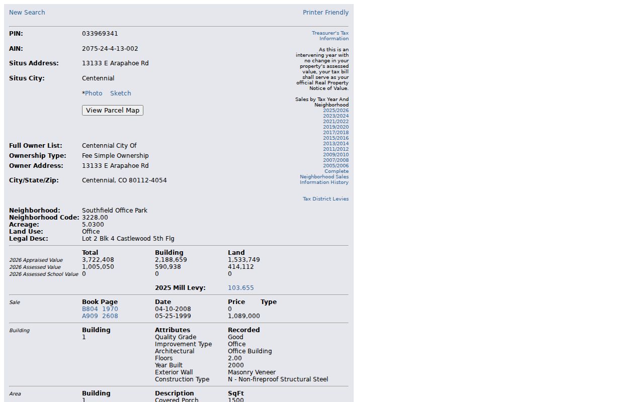
The sample record uses a city-owned parcel to show legal description, owner, situs, sales, and building fields without presenting a private owner as a street-directory subject.
Note: An OCR hit is a finding aid; open the official image or request a copy before treating a document detail as settled.
Centennial Voter Records by Street
A street-level voter question needs a list type, file date, and geography. The Arapahoe Basic Voter List is an active registered-voter list updated each weekday except holidays. Other files add districts, voter history, voter details, ballots, or rejected cures. Custom orders can specify a precinct or district, party, status, and a five-year, twenty-year, or named-election slice.
Public fields can include name, address, status, precinct, district, and voting history, but confidential voters, preregistered voters under 18, and protected fields are omitted. Social Security numbers, driver-license or state-ID numbers, email, signatures, month and day of birth, and how a person voted are not released in the ordinary file. A street directory should never turn an election file into a contact list.
A statewide voter service handles registration and statewide services. The county lookup has dynamic fields, so a saved result should name the exact county tool, list, file date, and source URL. If a name is absent, check confidentiality and list scope before drawing a conclusion.
Centennial Permits and Code Files
City records can describe activity at a street address without becoming a resident roster. The City departments directory routes readers to online Building and Planning Records, Meeting Records, and a Public Records Request Form. The city says it confirms a request by email, reviews scope, and may follow up about clarification, fees, or time. CORA timing is generally three working days with a possible seven-working-day extenuating extension.
The Code Compliance page lists complaint types such as fence maintenance, hazardous trees, junk or inoperable vehicles, outdoor storage, refuse containers, and right-of-way obstructions. A report can be anonymous. If contact information is supplied, the city warns that it becomes public and cannot be deleted. Initial inspection is targeted within three business days, and a confirmed violation can move from voluntary compliance to a ticket, abatement, or fine.
The city’s OpenForms route asks for requestor name, phone, email, a specific description, and whether copies are requested. Conditional branches cover court or criminal-justice records, discovery, and zoning information. The zoning-verification path routes to the EnerGov self-service portal. The CORA/CCJRA fee schedule and municipal code access should be checked for reproduction and code questions. Exact EnerGov search fields were not exposed in the research capture, so they should not be promised.
The official request page shows how an address record can be obtained when a direct online index is not available.
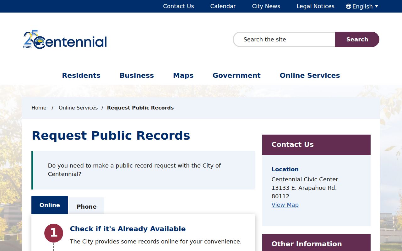
Use the request form for a defined record category and date range, and ask for electronic copies when that fits the request. Do not ask the city to create a new list of people from unrelated records.
Centennial ZIP Last Lines
A ZIP code can make a street search look more exact than it is. The 2025 city packet says six ZIP codes occur within Centennial and cross neighboring municipalities or unincorporated county areas. Official city examples include 80015, 80016, 80111, 80112, 80121, and 80122, while the packet records a discussion of last-line changes rather than a completed postal rewrite.
Use USPS to standardize a street line, then use the assessor and GIS to decide whether the parcel is inside the city. Statistical ZCTAs are polygons and do not equal USPS delivery geography. A last line can name a neighboring place without changing the parcel’s municipal jurisdiction.
For a street directory result, save the street, unit, ZIP, parcel ID, city field, and source date separately. That small record of the search prevents a later reader from assuming the postal city and legal city were the same at every point in time.
Centennial Criss-Cross Records
Older street work shifts from the modern parcel chain to householder and reverse directory pages. Regional library collections describe name-arranged city directories, address-arranged householder directories, business directories, and telephone books. A name page may give an occupation and residence abbreviation. The street section can then supply the building, intersection, or occupant context.
Because Centennial did not exist as a municipality before 2001, search older volumes under the historical county or town label. An 1887 street directory volume demonstrates the address arrangement, while a directory guide explains collection limits. For the full year and publisher treatment, use the Centennial city directory collections page.
- Criss-cross directory
- A reverse section arranged by street or address rather than only by personal name.
- Householder directory
- An address-oriented directory that may list an owner, resident, business, or household head for a given year.
- Historical jurisdiction
- The city, county, or rural place name used when the directory was published.
Use a directory as a time-stamped clue. A missing name can reflect a gap in coverage, a move, a name change, or a different page arrangement.
Centennial Street Directory Limits
The strongest street record is still only a record of a role. A parcel owner may be a person, trust, LLC, bank, estate, or city. A mailing address may sit elsewhere. A deed party may have signed as a trustee or representative. A voter address is dated and may be excluded through a confidentiality program. City code records can expose a reporter’s contact details if the reporter supplied them, while household members and utility customers are not public street fields.
Colorado’s Address Confidentiality Program provides a legal substitute address and mail forwarding for eligible survivors, and confidential voters are excluded from ordinary lists. The Colorado Privacy Act and custodian rules also affect access, correction, and reuse. Do not copy signatures, account numbers, exact protected addresses, or a full document image when a role and source date answer the question.
Lawful personal use. Use the Centennial street directory for family history, parcel research, civic transparency, or a personal safety question. Do not use street or address records to stalk, harass, intimidate, or harm anyone.
When the goal shifts from a whole street to one person, the Centennial resident lookup workflow is the safer way to reconcile name, role, geography, and date.